
Macclesfield Forest Management Plan
The Macclesfield Forest and Wildboarclough Study Area lies on the western fringe of the Peak District National Park close to Macclesfield. It lies within Macclesfield Borough and Cheshire county, with about two-thirds of the area within the National Park. It includes Tegg's Nose Country Park, owned and managed by Cheshire County Council.
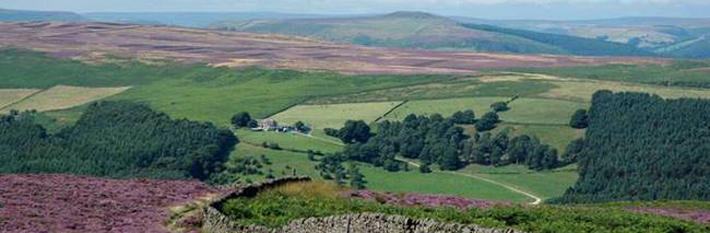
The area consists of a pleasing mix of reservoirs, woodland, farmland and moorland, with scattered farms and hamlets; the village of Langley lies on its western boundary. It is crossed by narrow roads, footpaths and bridleways; the Gritstone Trail and the Cheshire Cycleway pass through it.
A management plan for the area was produced in 1979 by a partnership of Cheshire County Council, Macclesfield Borough Council, North West Water Ltd (now United Utilities) and the Peak District National Park Authority. Its aim was to provide suitable recreation opportunities for visitors while safeguarding the needs of farming, forestry, water catchment, local residents and nature conservation. Many of the plan's recommendations have been implemented and the area remains popular with visitors.
This new Management Plan for the area has built on the earlier plan's successes and has been updated with greater reference to sustainability, social inclusion and community involvement.
Macclesfield Forest & Wildboarclough Management Strategy and Action Plan (685KB)