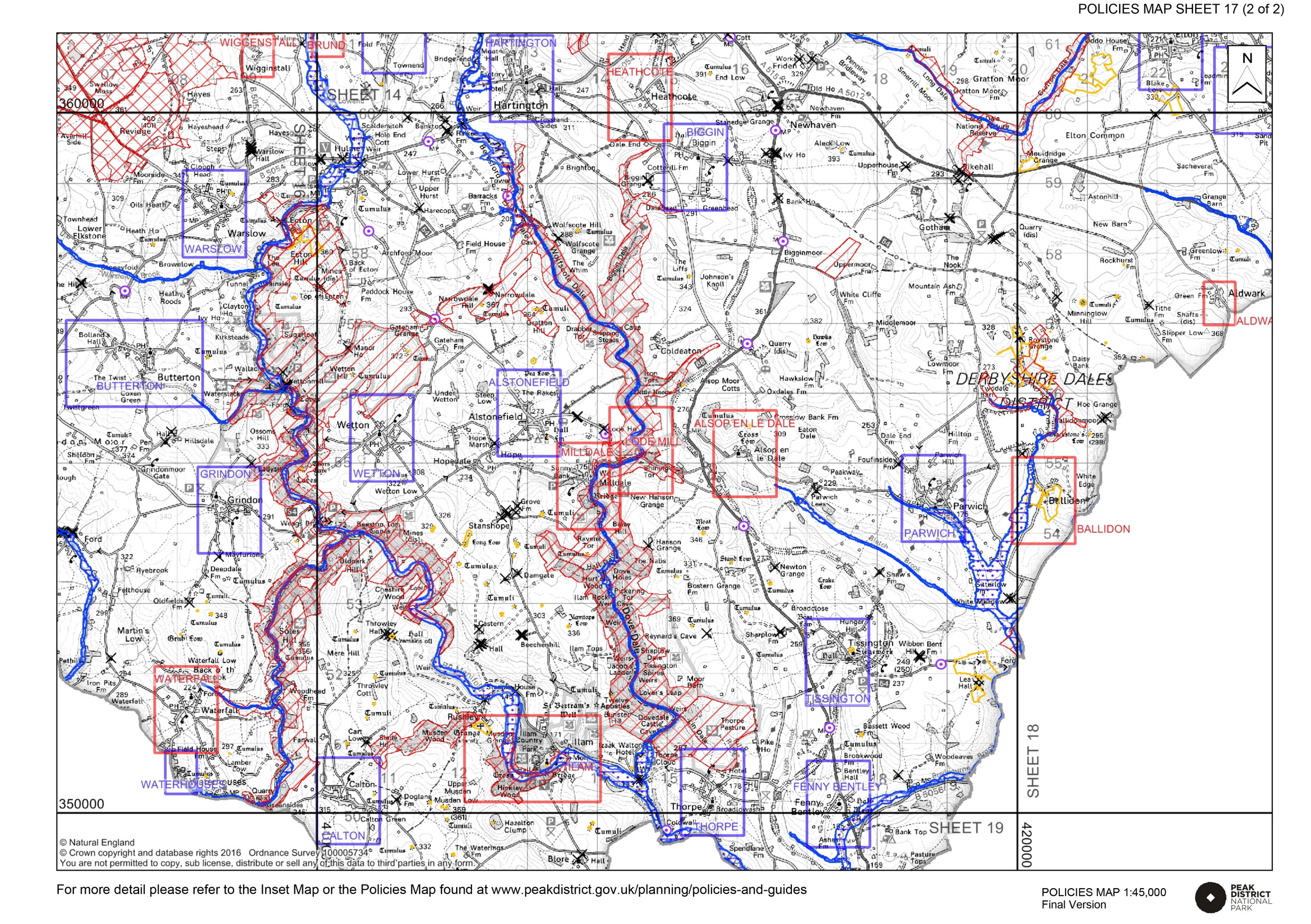
These tile maps form part of the Peak District National Park Development Management Policies. Please read the guidance notes for more information. Click map tiles and inset maps for more detail.
Map printed from https://www.peakdistrict.gov.uk/dmpmaps Switch between landscape and portrait print modes and adjust scale if map splits across pages.
Sheet 1 - landscape character
Sheet 2 - other designations and constraints
×
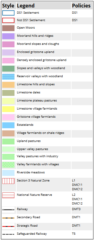
Landcape
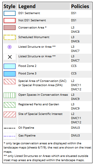
Other designations
Crown copyright and database rights 2020. Ordnance Survey 100005734. You are not permitted to copy, sub-licence, distribute or sell any of this data to third parties in any form.