
Car park locations
There are almost 2,000 car parking spaces across 44 Peak District National Park Authority car parks [listed below] that allow you to park safely and avoid damaging landscape and habitats in the National Park.
Please use the car parks provided and help to keep roads safer and clear for farm vehicles and the emergency services. All of the money collected in parking charges goes back into helping us look after the National Park and providing visitor facilities.
Did you know we have both annual and weekly parking permits available for regular visitors, which can save you up to £75 a year if you visit just twice a month? These permits can be used in any Peak District National Park Authority pay and display car parks with the millstone logo shown below.
A pay and display ticket is not transferable from one vehicle to another and on transfer the ticket ceases to be valid. A pay and display ticket is only valid in the parking place in which it was issued. This is defined by the reference code of the ticket machine located in that parking place printed on the pay and display ticket.
EV charging points: these are available at Millers Dale station and Parsley Hay. Download the Podpoint app before your journey.
Cash and card payments are not available in all locations, so please be prepared for our coin only and card only machines. The payment methods are shown below.
Cashless payment by app
Peak District National Park Authority car parks requiring Pay & Display now offer a quick and easy alternative to pay by phone with RingGo, the UK’s no.1 parking app.
If phone reception is not available at time of parking, please take a note of the location number and pay immediately after your visit, usually this will need to be within 24 hrs to avoid any further action in relation to non-payment. This applies to the following sites:
- Derwent Overlook
- Hartington Station
- Milldale
- Millers Dale
- Upper Burbage Bridge
How to use RingGo:
- Download the RingGo app - go to the App Store or Google Play Store and search for RingGo.
- Set up an account by registering a few details so the next time you want to park, you can pay in seconds.
- When you park in an area where RingGo is offered, you need to:
- Confirm your vehicle registration number (with no spaces).
- Enter the five or six-digit location number shown on signs at the location. For example, if there is a sign with ‘234567’ displayed, this is the location code you must use.
- Select how long you want to stay.
- Confirm your payment details.
If your parking is running out, you can extend the time wherever you are by using the RingGo app. Select your current parking session from the sessions tab and the app will ask how long you want to extend. Choose a time, confirm and your parking is sorted.
None of our car parks have height restriction barriers in place and are therefore suitable for small to medium sized motorhomes visiting during the daytime. Some of our car parks are lined so may not be suitable for larger vehicles in the marked bays. Bakewell Station is not suitable for motor homes and other larger vehicles.
Overnight parking at all of our car parks is prohibited, and may be subject to patrols.
Disabled parking: Please contact our Customer Services team for information on the most suitable car park locations, accessible trails and cycle hire opportunities if you have additional mobility needs. We aim to provide clear demarked/delineated disabled bays where car park surfaces allow.
Download the full list of PDNPA car parks (215KB)
Car park map
View locations for PDNPA owned car parks and toilets. Ones run by other providers are not shown on the map.
Found 85 places
Agricultural Business Centre
Entrance on Agricultural Way on A6 south of Bakewell.
How to get there
See Derbyshire Dales website for directions and charges
Alsop Station
Alsop Station car park is near Alsop-en-le-Dale on the A515, halfway between Ashbourne and Buxton.
50 spaces . Pay & Display - cards only .
How to get there
Grid reference: SK 1550 5497 Map / sat nav What3Words: ///primary.pepper.coasting
Alstonefield
A small and accessible car park giving access to the pretty Staffordshire village of Alstonefield.
25 spaces ( 1 disabled) . Pay & Display - cards only . Toilets ( Radar key required) .
How to get there
Grid reference: SK1035 5564 Map / sat nav What3Words: ///bulldozer.create.husky
Bakewell Market Place
Bakewell Market is held on Monday; the car park is not available for public parking on Mondays until after 6pm.
How to get there
See Derbyshire Dales website for directions and charges
Bakewell Station
Small accessible car park at the top of Station Road near Bakewell Bridge giving level access onto the Monsal Trail. Car park not suitable for motor homes.
25 spaces ( 2 disabled) . Pay & Display - coins only .
How to get there
Grid reference: SK 2224 6898 Map / sat nav What3Words: ///typist.echo.available
Barber Booth
Mam Tor end of Edale Valley.
20 spaces . Pay & Display - cards only .
How to get there
Grid reference: SK 1075 8471 Map / sat nav What3Words: ///version.plod.secures
Binn Green
Off A635 road above Dovestone Reservoir on Saddleworth Moor near Oldham and Manchester
How to get there
See United Utilities website for directions and charges
Black Hill (Holmemoss)
Woodhead Road, Tintwistle.
How to get there
See United Utilities website for directions and charges
Blore Pastures
Pleasantly situated car park near Ilam (pronounced eye-lam) gives good views towards Dovedale and Thorpe Cloud. No dedicated disabled spaces and small gradient to car park.
55 spaces . Pay & Display - cards only .
How to get there
Grid reference: SK 1353 4990 Map / sat nav What3Words: ///should.refrain.putts
Bottom/Valehouse
Valehouse Reservoir, Tintwistle.
How to get there
See United Utilities website for directions and charges
Bowden Bridge
Small car park in old quarry near Hayfield. Start point of the 1932 mass trespass on Kinder Scout
27 spaces . Pay & Display - coins only . Toilets ( Radar key required) .
How to get there
Grid reference: SK 0487 8692 Map / sat nav What3Words: ///active.interests.arrow
Brookside
Small car park on Clough Road in Wildboarclough (pronounced Wilbercluff)
14 spaces . FREE .
How to get there
Grid reference: SJ 9802 6810 Map / sat nav What3Words: ///pencils.epic.birthdays
Bunsal Cob
Goyt Road, nr Buxton.
How to get there
See United Utilities website for directions and charges
Clough House car park
Free car park a mile north of Wildboarclough
25 spaces . FREE .
How to get there
Grid reference: SJ 9875 6989 Map / sat nav What3Words: ///noise.blur.bounding
Crowden
Car park with toilet just north of Torside reservoir, on the A628 Woodhead Pass.
25 spaces ( 1 disabled) . FREE . Toilets ( Radar key required) .
How to get there
Grid reference: SK 0730 9930 Map / sat nav What3Words: ///scanner.birds.simmer
Curbar Gap
Eastern Moors Partnership.
How to get there
See National Trust website for directions and charges
Dennis Knoll
near Stanage
10 spaces . Pay & Display - cards only .
How to get there
Grid reference: SK 2281 8438 Map / sat nav What3Words: ///wash.echo.beam
Derbyshire Bridge
Goyt Valley off the A537 Buxton to Macclesfield Road. Nearest railway station Buxton (approx 4 miles).
115 spaces ( 2 disabled) . FREE . Toilets .
How to get there
Grid reference: SK01857155 Map / sat nav What3Words: ///exotic.bells.hinders
Derwent Overlook
Large car park overlooking Ladybower Reservoir with good access to Fairholmes, the A57 and Bridge End
60 spaces . Pay & Display - coins only .
How to get there
Grid reference: SK 1735 8900 Map / sat nav What3Words: ///tearfully.stream.ridge
Digley Quarry car park
Holmfirth.
How to get there
See Yorkshire Water website for directions and charges
Digley South car park
Holmfirth.
How to get there
See Yorkshire Water website for directions and charges
Edale car and coach park
Car and coach park in Edale village
How to get there
See High Peak website for directions and charges
Erwood Hall
Goyt Road, Buxton.
How to get there
See United Utilities website for directions and charges
Fairholmes
Near Derwent Dam, Upper Derwent Valley.
How to get there
Fernilee Reservoir car parks
Fernilee reservoir area.
How to get there
See United Utilities website for directions and charges
Friden
Close to A515 Ashbourne to Buxton and A512 Via Gellia roads, Friden is ideal for exploring the High Peak and Tissington trails.
45 spaces . Pay & Display - cards only .
How to get there
Grid reference: SK 1725 6070 Map / sat nav What3Words: ///watch.meanings.unfit
Granby Road
Bakewell - car park is closed on Monday until 6pm due to Bakewell market.
How to get there
See Derbyshire Dales website for directions and charges
Hartington station
Follow sign to Tissington off the A515 Buxton to Ashbourne Road, then turn left just before the bridge and follow the road round.
70 spaces ( 5 disabled) . Pay & Display - coins only . Toilets Baby change available .
How to get there
Grid reference: SK 1496 6108 Map / sat nav What3Words: ///rephrase.turned.dunes
Heatherdene
Near Ladybower Reservoir, Upper Derwent Valley.
How to get there
Heyden
Woodhead Road, Tintwistle
How to get there
See United Utilities website for directions and charges
Hollin Bank
Below Stanage Edge.
75 spaces . Pay & Display - cards and coins . Toilets ( Radar key required) Baby change available .
How to get there
Grid reference: SK 2373 8375 Map / sat nav What3Words: ///sings.fees.land
Hooks Carr
Stanage Edge.
50 spaces . Pay & Display - cards only .
How to get there
Grid reference: SK 2469 8299 Map / sat nav What3Words: ///sweep.craft.bill
Hulme End
Near Warslow.
75 spaces . Pay & Display - coins only .
How to get there
Grid reference: SK 1029 5930 Map / sat nav What3Words: ///upper.flip.decking
Hurdlow
Near Buxton.
55 spaces . Pay & Display - cards only .
How to get there
Grid reference: SK 1281 6594 Map / sat nav What3Words: ///headsets.playful.send
Hurst Clough
Upper Derwent.
15 spaces . FREE .
How to get there
Grid reference: SK 1878 8762 Map / sat nav What3Words: ///painters.allies.cape
Langsett Barn car park
Stocksbridge.
How to get there
See Yorkshire Water website for directions and charges
Langsett Flouch car park
Stocksbridge.
How to get there
See Yorkshire Water website for directions and charges
Longdendale Trail - Blacks
On A628
How to get there
See United Utilities website for directions and charges
Longdendale Trail - Platt Street
How to get there
See United Utilities website for directions and charges
Longdendale Trail - Railway Cottages
How to get there
See United Utilities website for directions and charges
Longshaw - Woodcroft
National Trust Longshaw Estate.
How to get there
See National Trust website for directions and charges
Mam Tor Landslip
Top of Old Mam Tor Road, past Treak Cavern. Roadside parking.
FREE .
How to get there
Grid reference: SK1343 8348 Map / sat nav
Mapleton Lane
For Ashbourne Cycle Hire and Tissington Trail.
50 spaces . Pay & Display - cards and coins . Toilets Baby change available .
How to get there
Grid reference: SK 1751 4734 Map / sat nav What3Words: ///importing.planting.wire
Mapleton Lane (Overspill)
140 spaces . Pay & Display - coins only .
How to get there
Grid reference: SK 1751 4695 Map / sat nav What3Words: ///crust.booklets.flopped
Milldale
near Alstonefield.
40 spaces . Pay & Display - cards only .
How to get there
Grid reference: Map / sat nav What3Words: ///signs.universal.fatigued
Millers Dale
near Tideswell.
80 spaces ( 3 disabled) . Pay & Display - cards and coins . EV charging available Toilets .
How to get there
Grid reference: SK 1385 7328 Map / sat nav What3Words: ///thighs.suddenly.tabs
Minninglow
near Pikehall and close to Parsley Hay and Arbor Low
25 spaces . Pay & Display - cards only .
How to get there
Grid reference: SK 1943 5814 Map / sat nav What3Words: ///fabricate.walked.ripples
Monsal Head
Near Little Longstone.
How to get there
See Derbyshire Dales website for directions and charges
Moor Lane
Youlgreave
30 spaces . Pay & Display - cards only .
How to get there
Grid reference: SK 1947 6442 Map / sat nav What3Words: ///fights.sparkles.dollars
Nab Quarry
Wildboarclough
10 spaces . FREE .
How to get there
Grid reference: SJ 9730 6795 Map / sat nav What3Words: ///cabbage.moon.topics
Narlows Lane
Thorpe
45 spaces . Pay & Display - cards only .
How to get there
Grid reference: SK 1635 5048 Map / sat nav What3Words: ///nosedive.learning.pens
Oddfellows Road
Hathersage.
How to get there
See Derbyshire Dales website for directions and charges
Parsley Hay
Car park easily accessible from the A515 Ashbourne to Buxton Road.
90 spaces ( 5 disabled) . Pay & Display - cards and coins . Coach parking available Toilets Baby change available .
How to get there
Grid reference: SK1468 6371 Map / sat nav What3Words: ///apparatus.survived.mostly
Pym's Chair
Side End Lane, Kettleshulme.
How to get there
See United Utilities website for directions and charges
Standing Stones
Sutton near Macclesfield.
How to get there
See United Utilities website for directions and charges
Surprise View
A level tarmaced car park at the edge of moorland near Hathersage, adjacent to the busy Castleton to Sheffield road (A625).
80 spaces ( 2 disabled) . Pay & Display - cards only .
How to get there
Grid reference: SK 2518 8007 Map / sat nav What3Words: ///solved.zones.narrow
The Street
Goyt Valley.
80 spaces ( 6 disabled) . FREE .
How to get there
Grid reference: SK 0135 7561 Map / sat nav What3Words: ///subsets.snowstorm.doubt
Thorpe Station
Near Thorpe
45 spaces . Pay & Display - cards only .
How to get there
Grid reference: SK 1657 5033 Map / sat nav What3Words: ///jogging.orange.backhand
Tideswell Dale
near Tideswell.
60 spaces . Pay & Display - coins only . Toilets ( Radar key required) .
How to get there
Grid reference: SK 1540 7422 Map / sat nav What3Words: ///text.wisdom.comedy
Tissington
Near Tissington.
70 spaces . Pay & Display - cards and coins . Toilets ( Radar key required) .
How to get there
Grid reference: SK 1776 5205 Map / sat nav What3Words: ///listed.releasing.chair
Torside
Near Longdendale.
100 spaces . Pay & Display - cards only . Toilets .
How to get there
Grid reference: SK 0680 9831 Map / sat nav What3Words: ///gates.situates.clouding
Trentabank
Macclesfield Forest.
35 spaces . Pay & Display - coins only . Toilets .
How to get there
Grid reference: SJ 9617 7115 Map / sat nav What3Words: ///economics.stands.recall
Upper Burbage Bridge
Near Stanage and Higger Tor.
25 spaces ( 3 disabled) . Pay & Display - coins only .
How to get there
Grid reference: Map / sat nav What3Words: ///keep.ropes.blame
Upperdale
Monsal Dale
10 spaces ( 1 disabled) . FREE .
How to get there
Grid reference: Map / sat nav What3Words: ///agreed.snowmen.means
Vicarage Quarry
Wildboarclough
10 spaces . FREE .
How to get there
Grid reference: Map / sat nav What3Words: ///beaker.breaches.gaps
Waterhouses
Between Ashbourne and Leek on the A523.
90 spaces . Pay & Display - coins only . Toilets ( Radar key required) .
How to get there
Grid reference: SK 0857 5015 Map / sat nav What3Words: ///pancakes.chief.snowstorm
White Lodge
near Taddington.
45 spaces . Pay & Display - cards only . Toilets ( Radar key required) Baby change available .
How to get there
Grid reference: SK 1702 7060 Map / sat nav What3Words: ///classic.immune.opened
Winscar Broad Hill car park
Dunford Bridge.
How to get there
See Yorkshire Water website for directions and charges
Winscar Windleden Lane car park
Dunford Bridge.
How to get there
See Yorkshire Water website for directions and charges
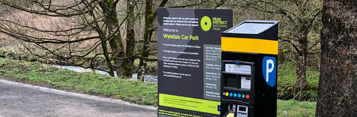
Wyedale
Topley Pike
28 spaces . Pay & Display - cards only .
How to get there
Grid reference: SK 1032 7249 Map / sat nav What3Words: ///pegs.twigs.rockets
New map testing
This uses the same ArcGIS template as above, but using a fixed URL with all the parameters turned on.