
Derwent Dam
Explore the drama of the Derwent Valley and the home of the Dambusters with the option of tramper and cycle hire. Local traffic on the road section of the route.

Access for All and Many
Distance: 600m to base of the dam tower, an additional 3km along the reservoir
Nearest Facilities: Fairholmes Visitor Centre and Cycle Hire
Directions
Access for All
- Descend the tarmac paths by the visitor centre to meet the road.
- Turn right down the road and cross the bridge to meet a turning area and path on the left.
- Pass through the gap at the side of the gate and continue to the base of the dam tower and interpretation panels.
Access for Many
- Continue up the road to the top of the hill.
- Turn left at the road junction and continue at a less steep gradient to the gate at the top of the dam where the tarmac finishes and the path levels out
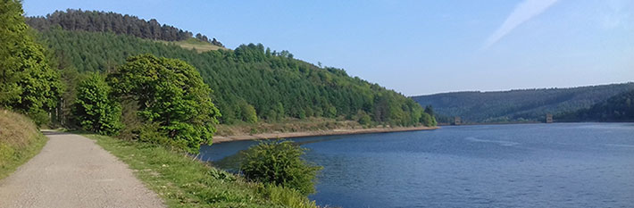
- Continue along the side of the reservoir, stopping where the path begins to descend.
Derwent Dam Route Map (165KB) ![]()
Getting there
Start at Fairholmes Visitor Centre, north of the A57 Glossop to Sheffield ‘Snake’ Road.
Ordnance Survey grid reference: SK 1724 8942
Postcode: S33 0AQ
Parking: 6 dedicated disabled
Toilet: open daylight hours; baby change
Refreshments: kiosk opening times 8am to 6pm
Information
- The River Derwent is Derbyshire’s and the Peak District’s major river.
- The RAF’s celebrated 617 squadron flew practice sorties here with their ‘bouncing bombs’, in preparation their epic 1943 raid on the dams of the German Ruhr.
- The twin-towered dam is at its most impressive when the water cascades over it.
Explore more


