
Access and rights of way
Public rights of way
Public rights of way are linear routes which fall into four categories. They are the legal responsibility of and maintained by Highway Authorities. Details of the routes are held on the Highway Authorities' Definitive Maps.
Footpaths - are for use on foot only.
They are shown on OS 1:25,000 Explorer maps as 
Bridleways - are for use on foot, on a horse or on a pedal cycle.
They are shown on OS 1:25,000 Explorer maps as 
Restricted byways – are for use on foot, on a horse or pedal cycle, or by horse drawn vehicle.
They are shown on OS 1:25,000 Explorer maps as 
Byways open to all traffic - are available for any mode of transport - on foot, on a horse, on a pedal cycle or motorcycle, or in a motor or horse-drawn vehicle. However, they are mainly for use as footpaths or bridleways and are usually unsealed.
They are shown on OS 1:25,000 Explorer maps as 
Other linear routes
Green lanes – is a term used to describe routes which have or may have the potential to carry motorised vehicle rights. They may be Byways open to all traffic (BOATS) or unsealed unclassified roads (UCRs). UCRs are often shown on OS 1:25,000 Explorer maps as ‘Other Routes with Public Access’ (ORPAs): 
More information on vehicles in the National Park can be seen at www.peakdistrict.gov.uk/vehicles.
Trails – are the former railway lines which are owned by the Authority and available for use on foot, on a horse or on a pedal cycle. More information on the trails can be seen at www.peakdistrict.gov.uk/trails.
Permissive paths - are where a landowner gives agreement for public access. There is no statutory legal right to use these routes and permission may be withdrawn. They are shown on OS 1:25,000 Explorer maps as footpaths  or bridleways
  .
.
Those that have been negotiated under farming grants can be seen at www.peakdistrict.gov.uk/peakpaths
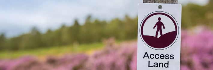
Access land
Access land is a term which covers area access. It falls into 3 categories:
Open access land – this is for access on foot. Additional rights may be provided by public rights of way or the landowner. The land is shown on OS 1:25,000 Explorer maps in a yellow wash or in a light green wash on woodlands. The NPA is responsible for managing access to and on this land. More information about land designated under the Countryside and Rights of Way (CRoW) Act 2000 can be seen at www.peakdistrict.gov.uk/crow.
Common land – this is shown on OS explorer maps in a yellow wash or in a light green wash on woodlands. There may be other rights in addition to a right on foot. The seven constituent councils in the National Park are Commons Authorities with the responsibility for common land.
Permissive access – this is where a landowner gives agreement for public access. This is usually negotiated under agri-environmental schemes and can be seen at www.peakdistrict.gov.uk/peakpaths. The National Park Authority, National Trust, Natural England, the water companies and the Forestry Commission also provide for public access on their land.