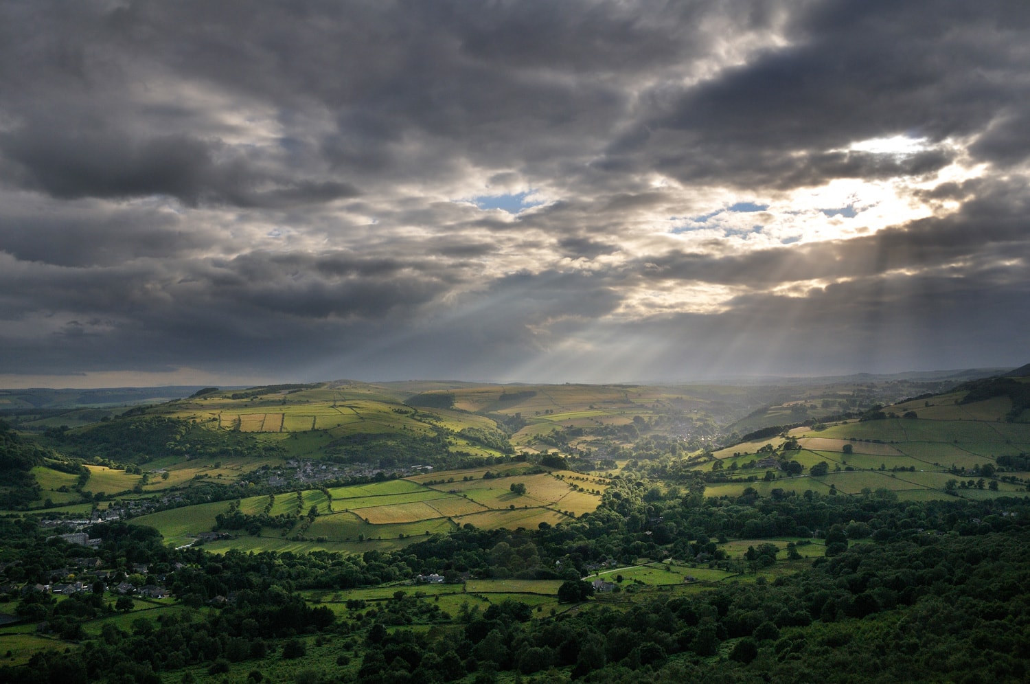
Car park locations
There are almost 2,000 car parking spaces across 44 Peak District National Park Authority car parks [listed below] that allow you to park safely and avoid damaging landscape and habitats in the National Park.
Please use the car parks provided and help to keep roads safer and clear for farm vehicles and the emergency services.
We provide car parks to help handle the numbers of visitors to the National Park and reduce congestion. Fees from our Pay & Display car parks are re-invested into the care and protection of landscapes local to that area and visitor facilities the car parks serve.
Did you know we have both annual and weekly parking permits available for regular visitors? These permits can be used in any Peak District National Park Authority pay and display car parks with the millstone logo shown below.
A pay and display ticket is not transferable from one vehicle to another and on transfer the ticket ceases to be valid. A pay and display ticket is only valid in the parking place in which it was issued. This is defined by the reference code of the ticket machine located in that parking place printed on the pay and display ticket.
EV charging points: these are available at Millers Dale station and Parsley Hay. Download the Podpoint app before your journey.
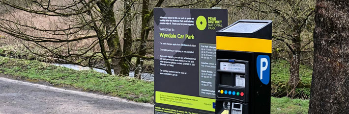
Please be aware that due to the rural location of most of our car parks, payment may be cash as well as card. A small number of locations may be cash or card only due to technical connectivity or security reasons.
The payment methods are shown below.
Cashless payment by app
All Peak District National Park Authority car parks requiring Pay & Display now offer a quick and easy alternative to pay with your phone by using RingGo, the UK’s no.1 parking app.
Late Pay Locations
There are a small number of our car parks where we know signal is an issue and we therefore allow payment to be made within 24 hours of parking. The sites only include:
- Bowden Bridge [RingGo 51705]
- Derwent Overlook [RingGo 51707]
- Hartington Station [RingGo 51709]
- Hurst Clough [RingGo 51736]
- Ilam Coach Park [RingGo 51737]
- Milldale [RingGo 51715]
- Millers Dale [RingGo 51716]
- Upper Burbage Bridge [RingGo 51727]
- Brookside [RingGo 51732]
- Clough House [RingGo 51733]
- Nab Quarry [RingGo 51738]
- Upperdale [RingGo 51741]
- Vicarage Quarry [RingGo 51742]
- Wyedale [RingGo 51730]
When using the sites listed above please take a note of the location number and pay within 24 hours of your arrival to avoid any further action in relation to non-payment. Please also ensure that the parking period you purchase covers the time that your car was in the car park.
For all other locations, a valid ticket, permit or blue badge must be on display or payment by phone submitted.
How to use RingGo
- Download the RingGo app - go to the App Store or Google Play Store and search for RingGo.
- Set up an account by registering a few details so the next time you want to park, you can pay in seconds.
- When you park in an area where RingGo is offered, you need to:
- Confirm your vehicle registration number (with no spaces).
- Enter the five or six-digit location number shown on signs at the location. For example, if there is a sign with ‘234567’ displayed, this is the location code you must use.
- Select how long you want to stay.
- Confirm your payment details.
If your parking is running out, you can extend the time wherever you are by using the RingGo app. Select your current parking session from the sessions tab and the app will ask how long you want to extend. Choose a time, confirm and your parking is sorted.
None of our car parks have height restriction barriers in place, however some are not suitable for larger vehicles.
Where a larger vehicle can use the car park, but is unable to fit within one car parking bay then they must pay for the number of bays the vehicle takes up and ensure the vehicle does not obstruct the area for other users, or may be subject to enforcement.
Overnight parking or camping at all of our car parks is prohibited, and may be subject to patrols and enforcement action.
Disabled parking: Please contact our Customer Services team for information on the most suitable car park locations, accessible trails and cycle hire opportunities if you have additional mobility needs. We aim to provide clear demarked/delineated disabled bays where car park surfaces allow.
Download the full list of PDNPA car parks (215KB)
Car park map
View locations for PDNPA owned car parks and toilets. These are the only locations where the PDNPA Permits are valid. Ones run by other providers are not shown on the map.
Found 87 places
Agricultural Business Centre
Entrance on Agricultural Way on A6 south of Bakewell.
How to get there
See Derbyshire Dales website for directions and charges
Alsop Station
Alsop Station car park is near Alsop-en-le-Dale on the A515, halfway between Ashbourne and Buxton.
50 spaces
|
Pay & Display - cards only
RingGo Location 51700
How to get there
Grid ref: SK 1550 5497 Map / sat nav W3W primary.pepper.coasting
Alstonefield
A small and accessible car park giving access to the pretty Staffordshire village of Alstonefield.
25 spaces
( 1 disabled)
|
Pay & Display - cards only
RingGo Location 51701
Toilets
( Radar key required)
How to get there
Grid ref: SK1035 5564 Map / sat nav W3W bulldozer.create.husky
Bakewell Market Place
Bakewell Market is held on Monday; the car park is not available for public parking on Mondays until after 6pm.
How to get there
See Derbyshire Dales website for directions and charges
Bakewell Station
Small accessible car park at the top of Station Road near Bakewell Bridge giving level access onto the Monsal Trail. Car park not suitable for motor homes.
25 spaces
( 2 disabled)
|
Pay & Display - cards only
RingGo Location 51702
How to get there
Grid ref: SK 2224 6898 Map / sat nav W3W typist.echo.available
Barber Booth
Mam Tor end of Edale Valley.
20 spaces
|
Pay & Display - cards only
RingGo Location 51703
How to get there
Grid ref: SK 1075 8471 Map / sat nav W3W version.plod.secures
Binn Green
Off A635 road above Dovestone Reservoir on Saddleworth Moor near Oldham and Manchester
How to get there
See United Utilities website for directions and charges
Black Hill (Holmemoss)
Woodhead Road, Tintwistle.
How to get there
See United Utilities website for directions and charges
Blore Pastures
Pleasantly situated car park near Ilam (pronounced eye-lam) gives good views towards Dovedale and Thorpe Cloud. No dedicated disabled spaces and small gradient to car park.
55 spaces
|
Pay & Display - cards only
RingGo Location 51704
How to get there
Grid ref: SK 1353 4990 Map / sat nav W3W should.refrain.putts
Bottom/Valehouse
Valehouse Reservoir, Tintwistle.
How to get there
See United Utilities website for directions and charges
Bowden Bridge
Small car park in old quarry near Hayfield. Start point of the 1932 mass trespass on Kinder Scout
27 spaces
|
Pay & Display - coins only
RingGo Location 51705
Toilets
( Radar key required)
How to get there
Grid ref: SK 0487 8692 Map / sat nav W3W active.interests.arrow
Brookside
Small car park on Clough Road in Wildboarclough (pronounced Wilbercluff)
14 spaces
|
Pay & Display - coins only
RingGo Location 51732
How to get there
Grid ref: SJ 9802 6810 Map / sat nav W3W pencils.epic.birthdays
Bunsal Cob
Goyt Road, nr Buxton.
How to get there
See United Utilities website for directions and charges
Carr Lane
Thornhill
20 spaces
|
Pay & Display - cards only
RingGo Location 51740
How to get there
Grid ref: SK1975 8392 Map / sat nav W3W hubcaps.defender.laugh
Clough House car park
Car park a mile north of Wildboarclough
25 spaces
|
Pay & Display - coins only
RingGo Location 51733
How to get there
Grid ref: SJ 9875 6989 Map / sat nav W3W noise.blur.bounding
Crowden
Car park with toilet just north of Torside reservoir, on the A628 Woodhead Pass.
25 spaces
( 1 disabled)
|
FREE Parking
Toilets
( Radar key required)
How to get there
Grid ref: SK 0730 9930 Map / sat nav W3W scanner.birds.simmer
Curbar Gap
Eastern Moors Partnership.
How to get there
See National Trust website for directions and charges
Dennis Knoll
near Stanage
10 spaces
|
Pay & Display - contactless only
RingGo Location 51706
How to get there
Grid ref: SK 2281 8438 Map / sat nav W3W wash.echo.beam
Derbyshire Bridge
Goyt Valley off the A537 Buxton to Macclesfield Road. Nearest railway station Buxton (approx 4 miles). Toilets temporarily closed (Nov 2025).
115 spaces ( 2 disabled) | FREE Parking
How to get there
Grid ref: SK01857155 Map / sat nav W3W exotic.bells.hinders
Derwent Overlook
Large car park overlooking Ladybower Reservoir with good access to Fairholmes, the A57 and Bridge End
60 spaces
|
Pay & Display - coins only
RingGo Location 51707
No signal? Pay by phone within 24 hours
How to get there
Grid ref: SK 1735 8900 Map / sat nav W3W tearfully.stream.ridge
Digley Quarry car park
Holmfirth.
How to get there
See Yorkshire Water website for directions and charges
Digley South car park
Holmfirth.
How to get there
See Yorkshire Water website for directions and charges
Edale car and coach park
Car and coach park in Edale village
How to get there
See High Peak website for directions and charges
Erwood Hall
Goyt Road, Buxton.
How to get there
See United Utilities website for directions and charges
Fairholmes
Near Derwent Dam, Upper Derwent Valley.
How to get there
Fernilee Reservoir car parks
Fernilee reservoir area.
How to get there
See United Utilities website for directions and charges
Friden
Close to A515 Ashbourne to Buxton and A512 Via Gellia roads, Friden is ideal for exploring the High Peak and Tissington trails.
45 spaces
|
Pay & Display - cards only
RingGo Location 51708
How to get there
Grid ref: SK 1725 6070 Map / sat nav W3W watch.meanings.unfit
Granby Road
Bakewell - car park is closed on Monday until 6pm due to Bakewell market.
How to get there
See Derbyshire Dales website for directions and charges
Hartington station
Follow sign to Tissington off the A515 Buxton to Ashbourne Road, then turn left just before the bridge and follow the road round.
70 spaces
( 5 disabled)
|
Pay & Display - cards and coins
RingGo Location 51709
No signal? Pay by phone within 24 hours
Toilets
Baby change available
How to get there
Grid ref: SK 1496 6108 Map / sat nav W3W rephrase.turned.dunes
Heatherdene
Near Ladybower Reservoir, Upper Derwent Valley.
How to get there
Heyden
Woodhead Road, Tintwistle
How to get there
See United Utilities website for directions and charges
Hollin Bank
Below Stanage Edge.
75 spaces
|
Pay & Display - cards and coins
RingGo Location 51710
Toilets
( Radar key required) Baby change available
How to get there
Grid ref: SK 2373 8375 Map / sat nav W3W sings.fees.land
Hooks Carr
Stanage Edge.
50 spaces
|
Pay & Display - cards only
RingGo Location 51711
How to get there
Grid ref: SK 2469 8299 Map / sat nav W3W sweep.craft.bill
Hulme End
Near Warslow.
75 spaces
|
Pay & Display - cards only
RingGo Location 51712
How to get there
Grid ref: SK 1029 5930 Map / sat nav W3W upper.flip.decking
Hurdlow
Near Buxton.
55 spaces
|
Pay & Display - cards only
RingGo Location 51713
How to get there
Grid ref: SK 1281 6594 Map / sat nav W3W headsets.playful.send
Hurst Clough
Upper Derwent.
15 spaces
|
Pay & Display - coins only
RingGo Location 51736
No signal? Pay by phone within 24 hours
How to get there
Grid ref: SK 1878 8762 Map / sat nav W3W painters.allies.cape
Ilam
Coaches and minibuses only (no cars, vans or motorhomes allowed). £20 for the whole day.
|
RingGo Location 51737
No signal? Pay by phone within 24 hours
Coach parking available
How to get there
Grid ref: SK 1444 5056 Map / sat nav W3W middle.footpath.forgotten
Langsett Barn car park
Stocksbridge.
How to get there
See Yorkshire Water website for directions and charges
Langsett Flouch car park
Stocksbridge.
How to get there
See Yorkshire Water website for directions and charges
Longdendale Trail - Blacks
On A628
How to get there
See United Utilities website for directions and charges
Longdendale Trail - Platt Street
How to get there
See United Utilities website for directions and charges
Longdendale Trail - Railway Cottages
How to get there
See United Utilities website for directions and charges
Longshaw - Woodcroft
National Trust Longshaw Estate.
How to get there
See National Trust website for directions and charges
Mam Tor Landslip
Top of Old Mam Tor Road, past Treak Cavern. Roadside parking.
| FREE Parking
How to get there
Grid ref: SK1343 8348 Map / sat nav
Mapleton Lane
For Ashbourne Cycle Hire and Tissington Trail.
50 spaces
|
Pay & Display - cards and coins
RingGo Location 51714
Toilets
Baby change available
How to get there
Grid ref: SK 1751 4734 Map / sat nav W3W importing.planting.wire
Mapleton Lane (Overspill)
140 spaces
|
Pay & Display - coins only
RingGo Location 51714
How to get there
Grid ref: SK 1751 4695 Map / sat nav W3W crust.booklets.flopped
Milldale
near Alstonefield.
40 spaces
|
Pay & Display - cards only
RingGo Location 51715
No signal? Pay by phone within 24 hours
How to get there
Grid ref: Map / sat nav W3W signs.universal.fatigued
Millers Dale
near Tideswell (between Bakewell and Buxton). Changing Places facility available.
80 spaces
( 3 disabled)
|
Pay & Display - cards and coins
RingGo Location 51716
No signal? Pay by phone within 24 hours
EV charging available
Toilets
How to get there
Grid ref: SK 1385 7328 Map / sat nav W3W thighs.suddenly.tabs
Minninglow
near Pikehall and close to Parsley Hay and Arbor Low
25 spaces
|
Pay & Display - cards only
RingGo Location 51717
How to get there
Grid ref: SK 1943 5814 Map / sat nav W3W fabricate.walked.ripples
Monsal Head
Near Viator Bridge. No accessible toilet.
How to get there
See Staffs Wildlife Trust website for directions and charges
Moor Lane
Youlgreave
30 spaces
|
Pay & Display - cards only
RingGo Location 51718
How to get there
Grid ref: SK 1947 6442 Map / sat nav W3W fights.sparkles.dollars
Nab Quarry
Wildboarclough
10 spaces
|
Pay & Display - coins only
RingGo Location 51738
How to get there
Grid ref: SJ 9730 6795 Map / sat nav W3W cabbage.moon.topics
Narlows Lane
Thorpe
45 spaces
|
Pay & Display - cards only
RingGo Location 51719
How to get there
Grid ref: SK 1635 5048 Map / sat nav W3W nosedive.learning.pens
Oddfellows Road
Hathersage.
How to get there
See Derbyshire Dales website for directions and charges
Parsley Hay
Car park easily accessible from the A515 Ashbourne to Buxton Road.
90 spaces
( 5 disabled)
|
Pay & Display - cards and coins
RingGo Location 51720
Coach parking available
Toilets
Baby change available
How to get there
Grid ref: SK1468 6371 Map / sat nav W3W apparatus.survived.mostly
Pym's Chair
Side End Lane, Kettleshulme.
How to get there
See United Utilities website for directions and charges
Standing Stones
Sutton near Macclesfield.
How to get there
See United Utilities website for directions and charges
Surprise View
A level tarmaced car park at the edge of moorland, adjacent to the busy Castleton to Sheffield road (A625).
80 spaces ( 2 disabled) | Pay & Display - cards only
How to get there
Grid ref: SK 2518 8007 Map / sat nav W3W worth.rods.crate
The Street
Goyt Valley.
80 spaces ( 6 disabled) | FREE Parking
How to get there
Grid ref: SK 0135 7561 Map / sat nav W3W subsets.snowstorm.doubt
Thorpe Station
Near Thorpe
45 spaces ( 51722 disabled) | Pay & Display - cards only
How to get there
Grid ref: SK 1657 5033 Map / sat nav W3W jogging.orange.backhand
Tideswell Dale
near Tideswell.
60 spaces
|
Pay & Display - cards only
RingGo Location 51723
Toilets
( Radar key required)
How to get there
Grid ref: SK 1540 7422 Map / sat nav W3W text.wisdom.comedy
Tissington
Near Tissington.
70 spaces
|
Pay & Display - cards and coins
RingGo Location 51724
Toilets
( Radar key required)
How to get there
Grid ref: SK 1776 5205 Map / sat nav W3W listed.releasing.chair
Torside
Near Longdendale.
100 spaces
|
Pay & Display - cards only
RingGo Location 51725
Toilets
How to get there
Grid ref: SK 0680 9831 Map / sat nav W3W gates.situates.clouding
Trentabank
Macclesfield Forest.
35 spaces
|
Pay & Display - cards and coins
RingGo Location 51726
Toilets
How to get there
Grid ref: SJ 9617 7115 Map / sat nav W3W economics.stands.recall
Upper Burbage Bridge
Near Stanage and Higger Tor.
25 spaces
( 3 disabled)
|
Pay & Display - coins only
RingGo Location 51727
No signal? Pay by phone within 24 hours
How to get there
Grid ref: Map / sat nav W3W keep.ropes.blame
Upperdale
Monsal Dale
10 spaces
( 1 disabled)
|
RingGo Location 51741
No signal? Pay by phone within 24 hours
How to get there
Grid ref: Map / sat nav W3W agreed.snowmen.means
Vicarage Quarry
Wildboarclough
10 spaces
|
Pay & Display - coins only
RingGo Location 51742
How to get there
Grid ref: Map / sat nav W3W beaker.breaches.gaps
Waterhouses
Between Ashbourne and Leek on the A523.
90 spaces
|
Pay & Display - cards only
RingGo Location 51728
Toilets
( Radar key required)
How to get there
Grid ref: SK 0857 5015 Map / sat nav W3W pancakes.chief.snowstorm
White Lodge
near Taddington.
45 spaces
|
Pay & Display - cards only
RingGo Location 51729
Toilets
( Radar key required) Baby change available
How to get there
Grid ref: SK 1702 7060 Map / sat nav W3W classic.immune.opened
Winscar Broad Hill car park
Dunford Bridge.
How to get there
See Yorkshire Water website for directions and charges
Winscar Windleden Lane car park
Dunford Bridge.
How to get there
See Yorkshire Water website for directions and charges
Wyedale
Topley Pike
28 spaces
|
Pay & Display - cards only
RingGo Location 51730
How to get there
Grid ref: SK 1032 7249 Map / sat nav W3W pegs.twigs.rockets