Castleton Family Walk
Part of our series of Family Walks Guides available across the Peak District. Printed copies are available in our Visitor Centres.
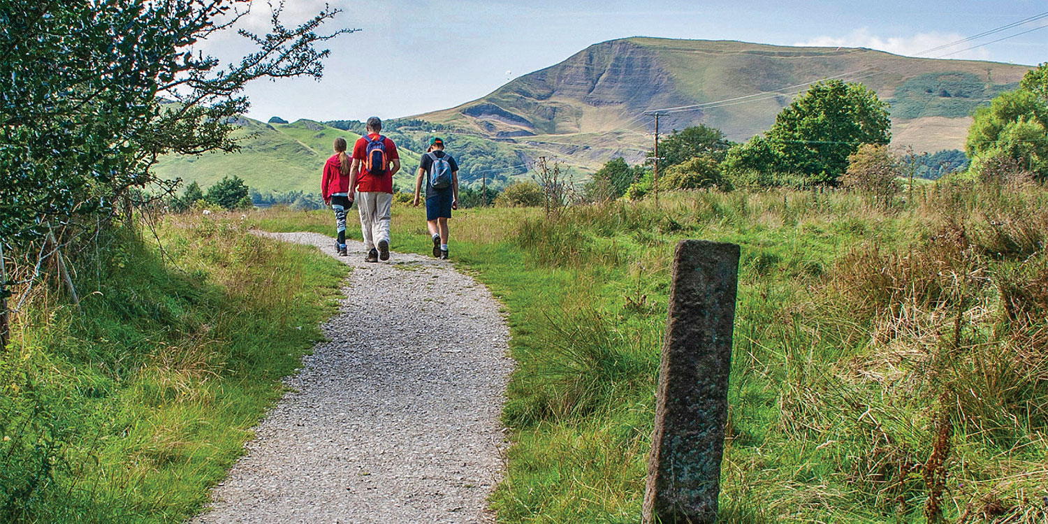
A walk taking in stunning scenery and exploring the history of the village. There is a children’s play area along the route.
Start from here
Castleton Visitor Centre car park.
There is a bus service (271, 272) from/to Sheffield
Driving directions
Postcode: S33 8WN
Grid reference: SK 149 829
What3Words: groomed.irrigated.garages
Nearby facilities
Your walk details
Distance: 1.4 miles /2.25km
Duration: Less than 1 hour
Buggy Friendly? Yes
Dog Friendly? Yes
Parking: P&D
Extra information Visitor centre, parking (pay and display), toilets, cafe This walk is on pavements or tarmac/gravel roads and is fairly level throughout. There are no stiles.
Routemap and directions
Download Castleton Family Walk routemap leaflet (763.6 KB)
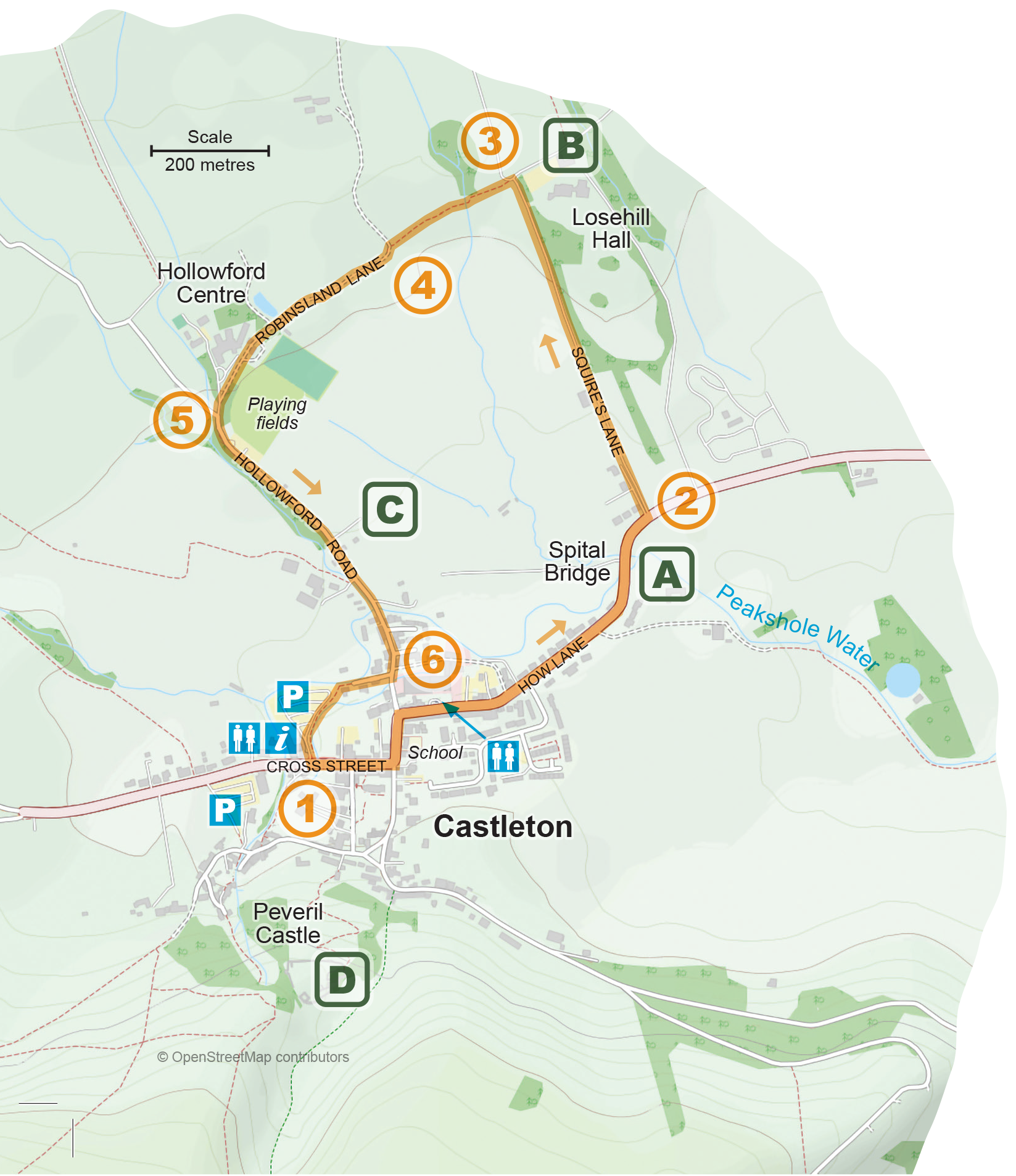
1. From Castleton Visitor Centre and car park turn left onto Cross Street and walk into the village. Follow the road to go left past the school and right by the post office, and continue to follow the main road (now How Lane) all the way through the village. After you have crossed the river (Peakshole Water) on Spital Bridge look out for a track on the left, just before the 40 mph sign at the edge of the village.
A Spital Bridge refers to a former medieval hospital, the remains of which have recently been excavated opposite the entrance to Losehill Hall. The bridge over Peakshole Water, near this site, is also now called Spital Bridge.
2. Cross the main road and turn left down the track (Squires Lane). Take the obvious right fork. This takes you along a gravel track with the grounds of Losehill Hall on your right and open fields on the left. From here there are great views of Mam Tor.
B Castleton Youth Hostel is the latest organisation to occupy Losehill Hall. Originally built in 1882 the building has been owned by the Co-op and the Peak District National Park Authority. It is a popular place for school groups to stay.
D Peveril Castle is a ruined 11th-century castle overlooking Castleton. It was the main settlement of a Norman knight, William Peverel, and was founded sometime between 1066 and 1086. Peveril Castle is one of England’s earliest Norman fortresses. The keep was built by Henry II in 1176.
3. Arriving at an obvious change of direction in the road turn left through a small gate into a field and walk in the direction of Castleton, crossing a tiny stream and a couple of fields. This is a gravel path. Mam Tor should be ahead of you.
Mam Tor (517m high) dominates the views to the west throughout this walk. It used to be an Iron Age settlement and there is evidence of hillfort ramparts circling the summit.
4. Fork left through the gate on to a lane and walk past some stables on the left to reach the Hollowford Centre on the right. Opposite the Centre are the village playing fields which are open to all. There are great views of Winnats Pass, Mam Tor and the castle along this section.
5. Just after the entrance to the Hollowford Centre turn left and walk down Hollowford Road back towards the village. Go past the cemetery and Candle House, re-crossing the river as you enter the village again.
C Candle House on Hollowford Road. Can you spot a lampshade with a candle on it? Candles that local lead miners used were made here. The candle factory was away from the village as the tallow used to make the candles was very smelly.
6 Turn right just after Ashton House down Eades Fold and follow it back to the car park and Visitor Centre.
Explore more
The following places are all close to Castleton Family Walk so why not make a day of it?