Dambusters Family Walk
Part of our series of Family Walks Guides available across the Peak District. Printed copies are available in our Visitor Centres.
Dambusters, Forests and Forgotten Farms
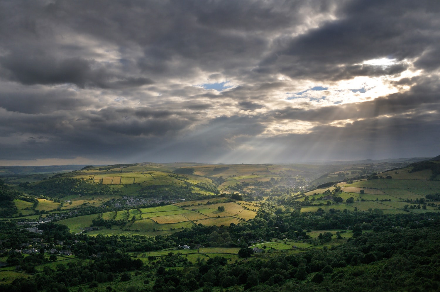
Explore the Upper Derwent Valley
Start from here
Fairholmes car park
The car park is well signposted on the Derwent Valley Road, off the A57
Driving directions
Postcode: S33 0AQ
Grid reference: SK 172 893
What3Words: intensely.branched.writers
Nearby facilities
Your walk details
Distance: 1 mile/1.5km
Duration: Less than 1 hour
Buggy Friendly? An easier route is to follow the path opposite the refreshment kiosk down to the dam wall, or to follow the signposted nature trail
Dog Friendly? Yes
Extra information Car park charges apply. Cash only at machines. Additional parking spaces close to the main car park on Derwent Lane
Routemap and directions
Download Dambusters Family Walk routemap leaflet (661.1 KB)
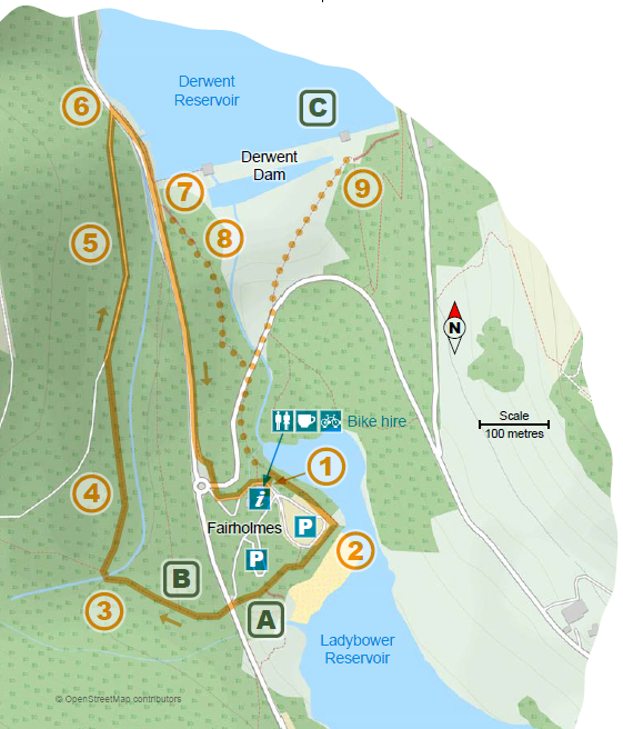
1. With your back to the Visitor Centre, pass tothe right of the information shelter and cross the zebra crossing. Turn right and walk around the edge of the car park, with the reservoir on your left. This route is marked by red arrows.
A Derwent village and several farms were flooded when the reservoirs were filled. Can you spot the remains of Fairholmes Farm just after you leave the car park?
2. Follow the path to the road, passing the site of the old Fairholmes Farm. Cross the road andgo straight ahead through the gate signed Lockerbrook.
B There was also a railway built to help in dam construction. Can you spot the remains of an old railway bridge as you walk up the hill through the woods?
3. Cross the concrete water channel and immediately turn right, eitherup the steps or by the short zig-zag ramp (signed to Derwent Dam)
4. Follow the path through the trees until it reaches the wider foresttrack and turn right.
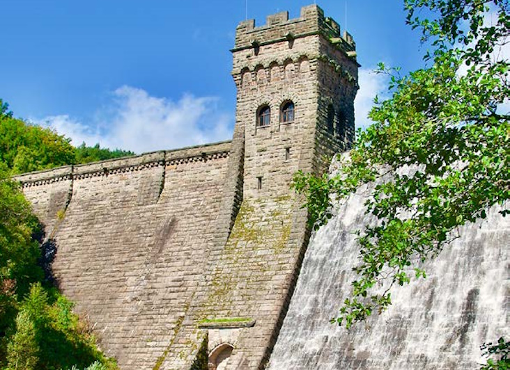
5 Follow the track past the Derwent Dam view point, down through a gate and to the road.
6 Cross the road and turn right through the pedestrian gate. Follow the footway, with thereservoir on your left, to the reservoir viewpoint.
During World War II, the valley was used by pilots of the 617 Squadron for practising the lowlevel flights needed for Operation Chastise, commonly known as the “Dam Busters” raids.
7 After Derwent Dam, carry on along the road past the car park. The easiest route back tothe Visitor Centre is to follow the footway on the left of the road all the way down to Fairholmes. Or if you wish to stand at the bottom of the dam you can turn left part way along the car park and go down the steps (dotted route on map).
8 If taking the latter option, follow the path until it forks and take the left fork downmore steps to the road. Turn left over the bridge and cross the grass to the dam.
C. Construction of Derwent Dam began in 1902, but it wasn’t completed until 1916.
9 Finally retrace your steps over the grass, to the road and follow the road until you see apath on the left leading to the Visitor Centre.
Workers building the dams lived in a temporary “tin town” at Birchinlee. Almost 900 people lived there, and there were shops, a school and even a hospital!
Explore more
The following places are all close to Dambusters Family Walk so why not make a day of it?